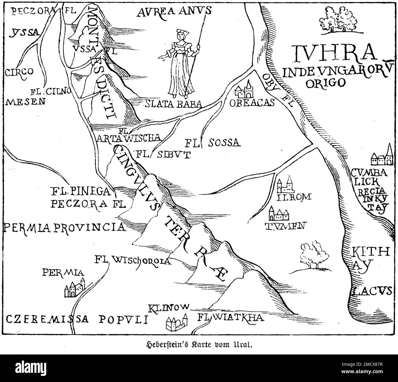
Maps are lying to you. Okay, maybe that’s a bit dramatic, but when you look at a standard ural mountain range map, you’re usually seeing a simplified version of a much messier reality. Most people think of the Urals as this sharp, jagged fence separating Europe from Asia. They picture a singular, clean line of snowy peaks.
The truth? It’s a 1,500-mile sprawl of ancient, weathered rock that’s often more "hilly" than "mountainous."
If you’re trying to trace the spine of Russia, you have to understand that this range isn't just one thing. It's a collection of five distinct regions—the Polar, Nether-Polar, Northern, Central, and Southern Urals. Each looks wildly different on a topographic map. While the Polar Urals are sharp and dramatic, the Central Urals are so low that you might drive right over them without realizing you’ve crossed into a different continent. Honestly, it's kinda underwhelming if you're expecting the Himalayas.
Reading the Ural Mountain Range Map Like a Local
To really get what’s going on, you need to look at the "bend." On any decent map, you’ll notice the range doesn't run perfectly North-South. It follows a slight "S" curve. This isn't random. It’s the result of the Uralian orogeny, a massive tectonic pile-up that happened about 250 to 300 million years ago.
The Urals are old. Really old.
While the Rockies or the Alps are still young and "pointy," the Urals have been sanded down by hundreds of millions of years of wind and ice. When you look at the ural mountain range map, the highest point you’ll find is Mount Narodnaya. It sits in the Nether-Polar region.
How high is it?
Only 1,895 meters (about 6,217 feet). For context, that’s shorter than many "small" peaks in the American West. But don't let the height fool you. The terrain is brutal. The Nether-Polar section is a labyrinth of deep cirques and glaciers. If you’re planning a trek there, you aren't just looking at elevation; you're looking at isolation. There are no roads. There are barely any trails. You’re navigating via satellite imagery and gut instinct.
The Five Sections You Need to Know
Most maps don't label these clearly, but they should:
The Polar Urals are the northernmost tip. They start at the Konstantinov Kamen mountain and run down to the Khulga River. This is tundra territory. It’s treeless, stark, and looks like something out of a Viking saga.
The Nether-Polar Urals come next. This is where the "big" peaks are. If you see a cluster of dark brown or purple on your topographic map, that's this area. It's the most alpine part of the range.
The Northern Urals are for the hardcore hikers. It’s a dense, taiga-covered wilderness. This is where the infamous Dyatlov Pass is located. If you've heard the ghost stories, this is the map coordinate you're looking for. It's beautiful, but it's also incredibly unforgiving.
The Central Urals are the lowest part. Think of them as the "Basement of the Urals." Near Yekaterinburg, the mountains barely reach 500 meters. This is the industrial heart of the range. Because the mountains are so low here, it’s where the major railroads and highways cross from Europe to Asia.
The Southern Urals are where things get wide. The range fans out here into several smaller ridges. It’s also the most diverse ecologically, moving from dense forests into the start of the Kazakh steppes.
The Europe-Asia Border Mystery
Here is where the ural mountain range map gets controversial. There is no "official" international treaty that says exactly where Europe ends and Asia begins. It's a convention.
In the 18th century, a guy named Vasily Tatishchev—a prominent geographer and statesman—was the one who really pushed the idea of the Urals as the continental divide. Before him, people used the Don River or other landmarks. Tatishchev argued that the distinct flora and fauna on either side of the mountains made them the natural boundary.
But if you look at a map, where do you draw the line?
In the Southern Urals, the mountains split into several branches. Does the border follow the main ridge? The Ural River? Geographers still argue about this. If you visit Yekaterinburg, you’ll find several "Europe-Asia" monuments. Some are miles apart. Basically, the "border" is wherever the local tourism board decides to put a stone pillar.
Wealth Under the Rock
The reason Russia cares so much about this range isn't the scenery. It's the periodic table.
If you look at a geological ural mountain range map, it's a mess of colors representing different minerals. The Urals are arguably the most mineral-rich mountains on the planet. We’re talking gold, platinum, coal, iron, and precious gems like malachite and emeralds.
In the 1930s, the Soviet Union turned the Southern Urals into an industrial fortress. Magnitogorsk, a city built around a mountain that was literally made of iron ore, is the prime example. They mined so much of "Magnet Mountain" that the mountain itself is basically gone now. It’s a pit. When you look at modern satellite maps of the Urals, you’ll see these massive scars in the earth. It’s not "untouched" wilderness. It’s a working mountain range.
Practical Tips for Using a Map to Plan a Trip
Don't just use Google Maps. It’s useless for the Urals once you get off the main highways.
Get Soviet-era military maps (Genshtab). You can find digital versions of these online. Even though they’re old, the topographic detail is insane. They show every tiny creek, bog, and ridge that modern digital maps often smooth over.
Pay attention to the "Kurums." On a good map, you might see areas marked as rock fields. Locals call them "kurums." These are rivers of massive boulders that "flow" down the mountainsides. They are a nightmare to walk on. If your map shows a steep incline with no vegetation, expect kurums.
Check the river directions. In the Northern and Polar Urals, the rivers on the western side flow toward the Pechora and Kama basins (Europe). Rivers on the eastern side flow toward the Ob basin (Siberia). This is the best way to orient yourself if your GPS dies.
💡 You might also like: this postWatch for the "Closed Cities." Look for areas on the map that seem strangely empty or have "numbered" names (like Ozersk or Snezhinsk). These were—and some still are—closed administrative-territorial entities related to Russia’s nuclear and defense industries. You cannot just wander into these areas. Your map might show a road that suddenly ends at a fence.
The Real Climate Divide
The ural mountain range map also serves as a giant weather wall. The Atlantic air masses lose most of their moisture on the western slopes.
The result?
The western side (Europe) is much wetter and greener. It’s covered in lush forests. The eastern side (Siberia) is in a "rain shadow." It’s much drier and has more extreme temperature swings. If you’re camping on the western side, prepare for rain. If you’re on the eastern side, prepare for the "Siberian High" to freeze your toes off in the winter.
The Urals aren't just a line on a piece of paper. They are a massive, ancient, and complicated barrier that shaped the history of two continents. Whether you’re looking at them for a geography project or planning a wild expedition to the Polar circle, remember that the map is just the beginning. The real magic—and the real danger—is in the details the 2D lines can't show.
Actionable Insights for Navigating the Urals
- Download Offline Topo Maps: Use apps like OsmAnd or Locus Map that allow you to layer high-contrast topographic data. Standard road maps will fail you in the Northern taiga.
- Identify the "Europe-Asia" Markers: If you're driving the P242 highway between Perm and Yekaterinburg, look for the white obelisk at the 300km mark. It's the most iconic photo op for the continental crossing.
- Check Seasonal Accessibility: The "roads" in the Polar Urals shown on some maps are often "zimniks" (winter roads). They only exist when the ground is frozen solid. In the summer, those "roads" turn into impassable swamps.
- Consult Local Forestry Maps: For serious hiking in areas like Taganay or Zyuratkul, find "lesnichestvo" (forestry) maps. They show the specific firebreaks and old logging trails that are the only way through the dense undergrowth.
The Ural Mountains are a place where the map actually matters. One wrong turn in the Northern Urals doesn't just mean you're lost; it means you're hundreds of miles from the nearest human being. Respect the lines, but study the space between them.