Tokyo is huge. Looking at Tokyo on a map for the first time usually leads to a specific kind of disorientation because the city doesn't really have a "middle" in the way New York or London does. If you open Google Maps and type in the name, the pin usually drops right on the Imperial Palace. That makes sense historically. But if you're trying to figure out where to stay or how to get around, that single dot is almost useless.
It’s a massive, pulsating sprawl. Honestly, the geography of the Japanese capital is more like a collection of twenty-three separate cities that all crashed into each other and decided to share a train system.
The Optical Illusion of the Kanto Plain
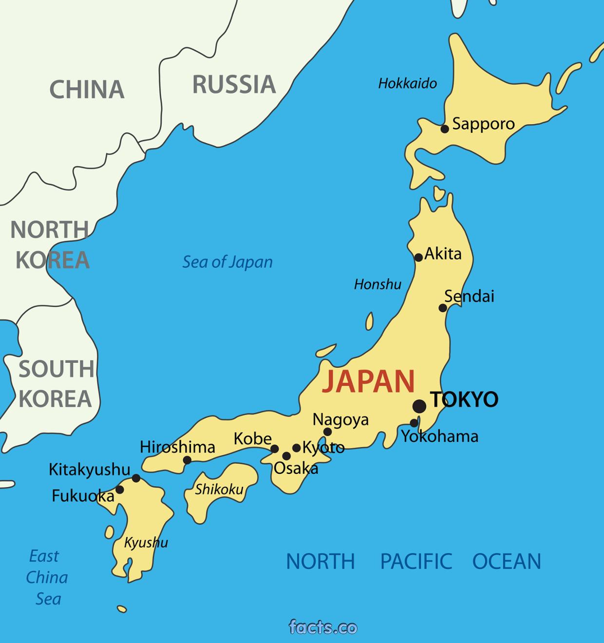
When you find Tokyo on a map of Japan, you’ll see it tucked into the corner of the Kanto Plain. It sits right on Tokyo Bay, looking out at the Pacific. Most people don't realize that Tokyo is actually part of the largest metropolitan area on Earth. We are talking about 37 million people. That is more than the entire population of Canada squeezed into one corner of an island.
The scale is deceptive. You see a green patch on the map and think, "Oh, I'll just walk from Shinjuku to Shibuya."
Don't do that.
Unless you want to spend forty-five minutes power-walking through dense concrete canyons, take the train. The city is built on a series of hills and reclaimed land. If you look at a topographical map, you can actually see the "High City" (Yamanote) where the wealthy estates used to be, and the "Low City" (Shitamachi) near the Sumida River where the merchants lived. That geographic divide still defines the vibe of the neighborhoods today. Shitamachi feels older, flatter, and more cramped. Yamanote is where you find the winding, hilly streets of places like Azabu-juban.
Deciphering the 23 Wards
Standard maps show the "23 Special Wards." These are the heart of the city. But then you have Western Tokyo—the Tama area—which stretches all the way into the mountains. You can literally be in Tokyo and be standing on a 2,000-meter peak like Mount Kumotori. It’s wild. Most tourists never see that side. They stay inside the Yamanote Line loop.
The Yamanote Line is basically the "skeleton" of any good map of the city. It’s a circular train line. If you can find that green circle, you can orient yourself anywhere. Shinjuku is on the left (West), Ueno is on the right (East), Shinagawa is at the bottom (South), and Ikebukuro is at the top (North).
Why the Address System is a Nightmare
Mapping Tokyo is a headache because Japan doesn't use street names. Aside from a few big boulevards like Meiji-dori or Omotesando, streets are nameless.
Instead, the city is carved into blocks.
When you look at a digital map of a Tokyo neighborhood, you'll see numbers like 3-5-1. That’s the "Chome," the "Banchi," and the "Go." Basically, it’s a nested doll system. You find the district, then the block, then the specific building. And here is the kicker: buildings are often numbered by when they were built, not their physical order on the street.
Finding a specific tiny ramen shop using just a paper map is a rite of passage. You’ll probably fail. Even locals rely heavily on "koban" (police boxes) where officers have giant, hyper-detailed map books that show every single house and business in the neighborhood.
The Vertical City Problem
Traditional 2D maps are basically lying to you in Tokyo. The city is 3D.
You might see a shop located at a specific point on the map, arrive there, and find nothing but a concrete wall. That’s because the shop is on the 8th floor. Or it’s three levels underground in a subway mall. When looking at Tokyo on a map, you always have to check the "F" or "B" levels. B2 means two floors down. 7F means seven floors up.
Google Maps has gotten better at this by adding floor selectors, but it's still easy to get turned around. The Shinjuku Station map is so complex that people have actually made "dungeon crawler" RPGs based on its layout. It has over 200 exits. If you take the wrong one, you end up on the opposite side of a skyscraper district, and it'll take you twenty minutes to walk back.
The Water and the Reclaimed Land
If you look at historical maps from the Edo period (1603–1867), Tokyo looks completely different. Much of what we now call "Tokyo Bay" was water. Places like Odaiba, which is now a massive entertainment district with a giant robot statue, didn't exist. It was built on trash and reclaimed soil.
The city is constantly expanding into the sea.
This creates a weird geographic feeling. The "old" Tokyo is inland, while the "new" Tokyo is all glass and steel out on the water. If you look at a map of the subway, you’ll see the lines getting straighter and more grid-like as you move toward the bay. That’s because the land was planned by modern engineers rather than evolving from ancient footpaths.
The Green Lungs You Can See from Space
Despite the "concrete jungle" reputation, certain spots pop out on a satellite map. The Imperial Palace is a massive dark green void in the center. Meiji Jingu is another one. These aren't just parks; they are dense forests.
Then you have the Sumida River. It snakes through the eastern side of the city. In the summer, the maps of the riverfront light up for the fireworks festivals. It’s the lifeblood of the old city. If you ever feel lost, find the river. If the river is on your right and you’re heading north, you’re going toward Asakusa.
Practical Tips for Navigating the Sprawl
Most people get overwhelmed by the sheer density of icons when they look at Tokyo on a map. Don't try to see the whole city at once. It's better to treat each neighborhood like a small village.
- Download Offline Maps. The "pocket Wi-Fi" life is great until your battery dies in the middle of Golden Gai. Having an offline backup of the Minato and Shinjuku areas is a lifesaver.
- Use the "Dropped Pin" Trick. Since addresses are weird, if you find a cool bar, drop a manual pin. Don't rely on the business's listed address to get you back there.
- Follow the Tracks. Most maps highlight the train lines. Use them as your primary landmarks. The Chuo Line (Orange) cuts right through the middle, East to West. It's the quickest way to get from the "old" side to the "new" side.
- Learn the Kanji for your Station. Digital maps are great, but physical signs in smaller neighborhoods might only have limited English. Knowing that "Station" is 駅 (eki) helps you find the nearest exit on a local neighborhood map board.
The Reality of Distance
A common mistake is thinking you can see "Tokyo" in two days. You can't.
If you look at the map and see the distance between Narita Airport and downtown, it looks close. It's not. It's about 60 kilometers away. That’s an hour-long train ride on a high-speed express. Haneda is much closer, but even then, Tokyo’s sheer footprint means you'll spend a significant portion of your day just moving between map points.
The city is also surprisingly hilly. The "Yamanote" name literally means "Hand of the Mountain." You’ll be walking up and down slopes you didn't see on the 2D map. This is why Tokyoites are generally pretty fit—the geography demands it.
Mapping the "Secret" Tokyo
Beyond the neon, there are pockets that barely look like a city. Look at the western edge of the map, near the border with Kanagawa. You'll find the Todoroki Valley. It’s a jungle ravine right in the middle of the Setagaya ward. It’s barely visible on most tourist maps, but it’s there—a literal crack in the pavement that leads to a river and a temple.
That’s the beauty of this city. No matter how many times you look at Tokyo on a map, there is always a layer you missed. Whether it’s a basement jazz club or a rooftop shrine, the map is just a suggestion. The real city is tucked into the gaps between the coordinates.
Actionable Next Steps
- Audit your itinerary: Open a map and plot your "must-see" spots. If they aren't on the same train line, you’re going to spend 4 hours in transit. Group your activities by ward (e.g., Shibuya and Harajuku together).
- Check the elevation: If you have mobility issues, use Google Street View to check the "slopes" in areas like Roppongi or Kagurazaka. They are steeper than they look on a flat map.
- Identify your "Hub": Pick one station on the Yamanote Line as your base. Staying near a major hub like Ueno or Shinjuku makes the map much easier to navigate than staying in a "cool" but isolated neighborhood where you have to transfer three times to get anywhere.
- Download "Tokyo Subway Navigation": It's an official app that works offline. It is far more reliable for timing and platform numbers than general-purpose map apps when you are deep underground.