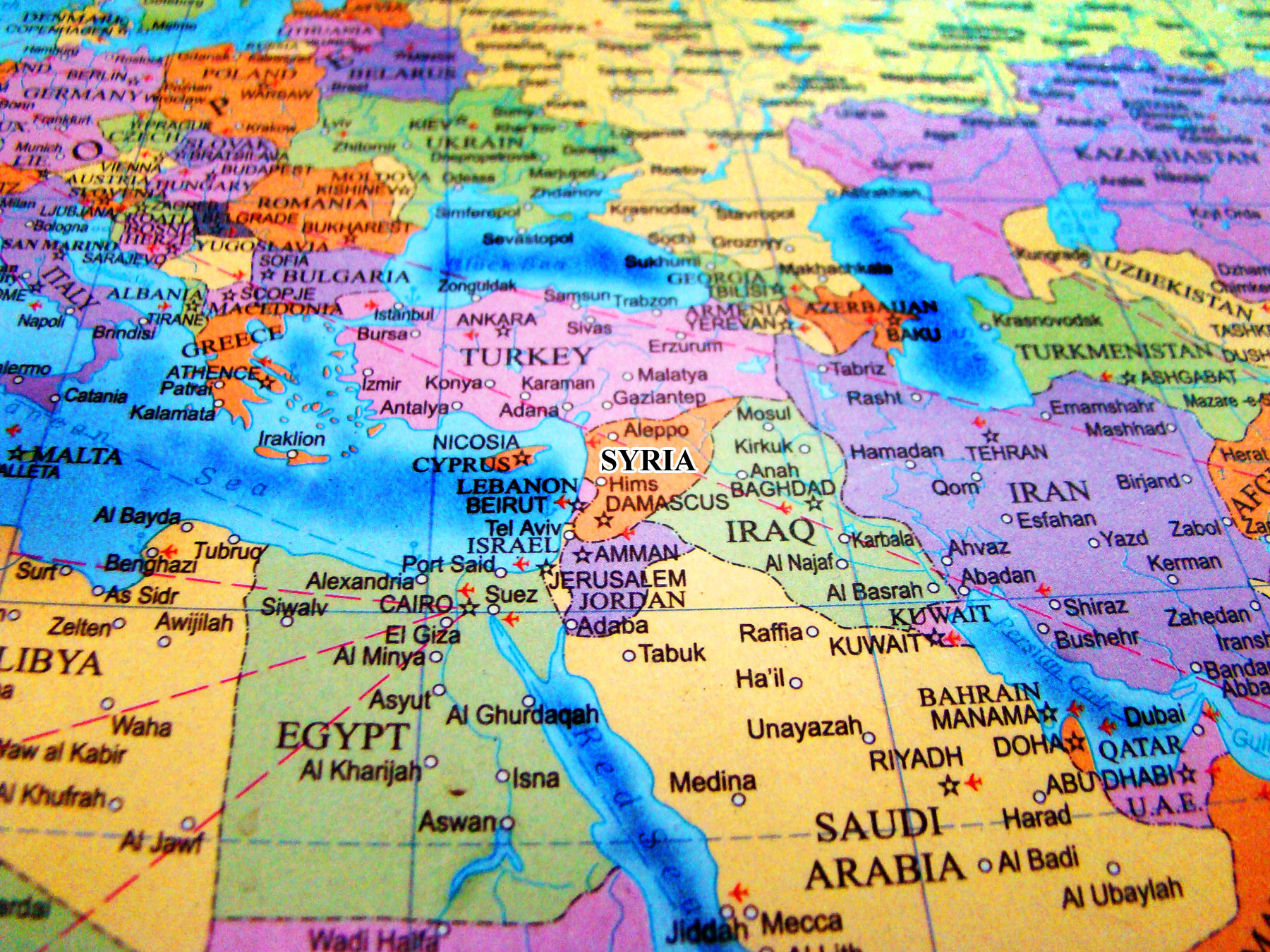
If you look for Syria on a world map, your finger will land right at the center of where everything started. It’s a tiny patch of Earth, honestly. Compared to the massive sprawl of Russia or the vastness of the Sahara, Syria looks almost bite-sized. But that little rectangle of land on the eastern edge of the Mediterranean Sea has a geographic weight that feels heavy. It’s the ultimate crossroads. Basically, if you were a trader, a conqueror, or a pilgrim moving between Europe, Asia, and Africa at any point in the last five thousand years, you had to deal with Syria.
It’s sitting right there at the coordinates 35°N 38°E.
Geography is destiny. You’ve probably heard that before, right? In Syria's case, it's not just a cliché; it’s a reality that has defined every war, every trade deal, and every cultural shift in the region. To the west, you have the Mediterranean. To the north, the rugged mountains of Turkey. To the east, Iraq and the path to the Persian Gulf. To the south, Jordan and the gateway to the Arabian Peninsula. It’s a literal bridge.
Where Syria on a world map actually sits
When you zoom in, you realize Syria isn't just one thing. It’s a weird, beautiful mix of environments. You have the lush, green coastal strip where the air smells like salt and citrus. Then you hit the mountain ranges—the Jabal an-Nusayriyah—which act like a wall, trapping the moisture from the sea. Once you cross those mountains, everything changes. The land flattens out into the vast Syrian Desert.
It's a stark contrast.
Most people think of Syria as just a big sandbox. That’s a mistake. The Euphrates River cuts right through the heart of the country, snaking down from the Turkish highlands. It’s the lifeblood of the eastern region. Without it, the history of places like Deir ez-Zor or the ancient ruins of Mari wouldn't even exist. The river made agriculture possible in a place that should, by all rights, be too dry to support a civilization.
The Neighbors Matter
You can’t talk about Syria’s location without talking about who lives next door. It’s a high-stakes neighborhood.
- Turkey sits to the north, sharing a massive 500-mile border.
- Iraq is to the east and southeast.
- Jordan holds the southern border.
- Israel and Lebanon are tucked into the southwest corner.
This specific placement is why Syria has been a "buffer state" for centuries. Whether it was the Romans and the Persians or the modern-day geopolitical tug-of-war, Syria is always in the middle. It’s the "beating heart of the Arab world," a title locals take very seriously.
The Levantine Connection and Why It’s Unique
Syria is the anchor of the Levant. That’s a fancy word for the lands bordering the eastern Mediterranean. If you look at Syria on a world map, you’ll see it’s part of a Fertile Crescent. This isn't just trivia. This is where humans first figured out how to farm wheat. This is where the first alphabets were scratched into clay.
The city of Damascus? It claims to be the oldest continuously inhabited city on the planet. People have been waking up, drinking coffee, and trading goods there for over 11,000 years. Think about that. When the pyramids were being built, Damascus was already an "old" city.
The geography allowed this longevity. The Barada River, though mostly a trickle now due to climate issues and mismanagement, created an oasis in the middle of a semi-arid plain. It’s a geographical miracle.
A Land of Micro-Climes
You could be skiing—or at least seeing snow—on Mount Hermon in the morning and then driving into the blistering heat of the Palmyrene desert by the afternoon.
The coast has a Mediterranean climate. Hot, dry summers. Mild, wet winters. Latakia and Tartus feel more like Greece or Italy than the stereotypical "Middle East." But as you move inland toward Aleppo or Hama, the air gets thinner and the temperature swings get more violent. Then you hit the Badia (the steppe), which eventually dissolves into the true desert toward the Iraqi border.
The Strategic Nightmare of the "Middle"
Being in the middle is great for business. It’s terrible for peace.
Because Syria connects the Mediterranean to the Silk Road routes, everyone has wanted a piece of it. The Assyrians, Babylonians, Egyptians, Greeks, Romans, Umayyads, Mongols, Ottomans, and the French—they’ve all left boots on this soil. If you look at a map of historical trade routes, they all converge on Aleppo.
Aleppo was the final destination of the Silk Road. Goods from China would arrive there before being shipped off to Venice or Marseille. This gave Syria an incredible amount of "soft power" long before that term was even invented. But it also meant that whenever a global power wanted to assert dominance in the East, Syria was the first place they invaded.
Why Borders Here Are So Complicated
The borders you see when you look at Syria on a world map today aren't "natural." They weren't drawn based on where people lived or what language they spoke. They were drawn with a ruler and a pencil by two guys named Sykes and Picot in 1916.
Britain and France basically carved up the corpse of the Ottoman Empire. This created some weird geographic realities. Families were split. Nomadic tribes suddenly found themselves needing passports to cross land they’d walked for a thousand years. The "straight lines" in the eastern desert are a dead giveaway of this colonial cartography.
Misconceptions About the Syrian Landscape
Let's clear some stuff up.
First, Syria isn't just flat. The Anti-Lebanon mountains along the western border are rugged and high.
Second, it’s not all brown. The "Ghab Plain" is one of the most fertile areas in the region.
Third, the Euphrates isn't the only river. The Orontes (Nahr al-Asi) is famous because it flows north—opposite to most rivers in the area.
These features dictate where people live. Most of the population is crammed into the western "V" shape. If you draw a line from Aleppo down through Hama and Homs to Damascus, and then branch out to the coast, that’s where the action is. The eastern half of the country is mostly sparsely populated desert, though it holds most of the country’s oil and gas reserves.
This disparity creates an internal tension. The "useful Syria" (the west) vs. the "resource Syria" (the east).
How to Read the Map Like an Expert
When you’re looking at Syria on a world map, don’t just look at the lines. Look at the elevations and the water.
- Find the Euphrates. It enters from Turkey in the north and exits into Iraq in the southeast. This is the "energy corridor."
- Locate the "Homs Gap." There’s a break in the coastal mountains near the city of Homs. This is the only easy way for sea breezes (and invading armies) to get from the Mediterranean into the interior. It’s why Homs has been strategically vital in every single conflict.
- The Golan Heights. To the southwest, this plateau is a massive geographic flashpoint. It’s high ground that overlooks both Damascus and northern Israel.
The geography hasn't changed, even if the politics have. The mountains are still there. The desert is still there. The hunger for a Mediterranean port is still what drives regional powers.
Actionable Insights for Understanding Syria's Place
If you want to truly grasp why Syria matters today, you have to look past the headlines and look at the topography.
- Study the "M5 Highway": This is the main artery connecting the north (Aleppo) to the south (Damascus). On a map, it follows the natural habitable zone. Control the M5, and you control the country.
- Watch the Water: Syria’s future isn't just about politics; it’s about the Euphrates. Upstream dams in Turkey significantly affect water levels in Syria. Understanding the map means understanding water rights.
- Acknowledge the Diversity: The map hides the fact that Syria is a mosaic. Alawites on the coast, Sunnis in the heartland, Kurds in the northeast, Druze in the south, and Christians scattered throughout. The geography gave these groups refuge in mountains and valleys, allowing them to maintain distinct identities for millennia.
The best way to appreciate this is to look at a 3D topographic map. You’ll see how the mountains shield the coast, how the rivers carve life through the dust, and why this specific patch of the world will always be the center of the story.
To explore further, compare a modern political map of the Middle East with a map of the Roman Empire at its height. You’ll find that the "Province of Syria" covered almost the exact same crucial ground. History doesn't repeat, but it definitely rhymes with geography. Check out the UNESCO World Heritage site lists for Syria—places like Palmyra and Bosra—to see how these physical locations were turned into architectural wonders that still define the "look" of the country from satellite imagery today.