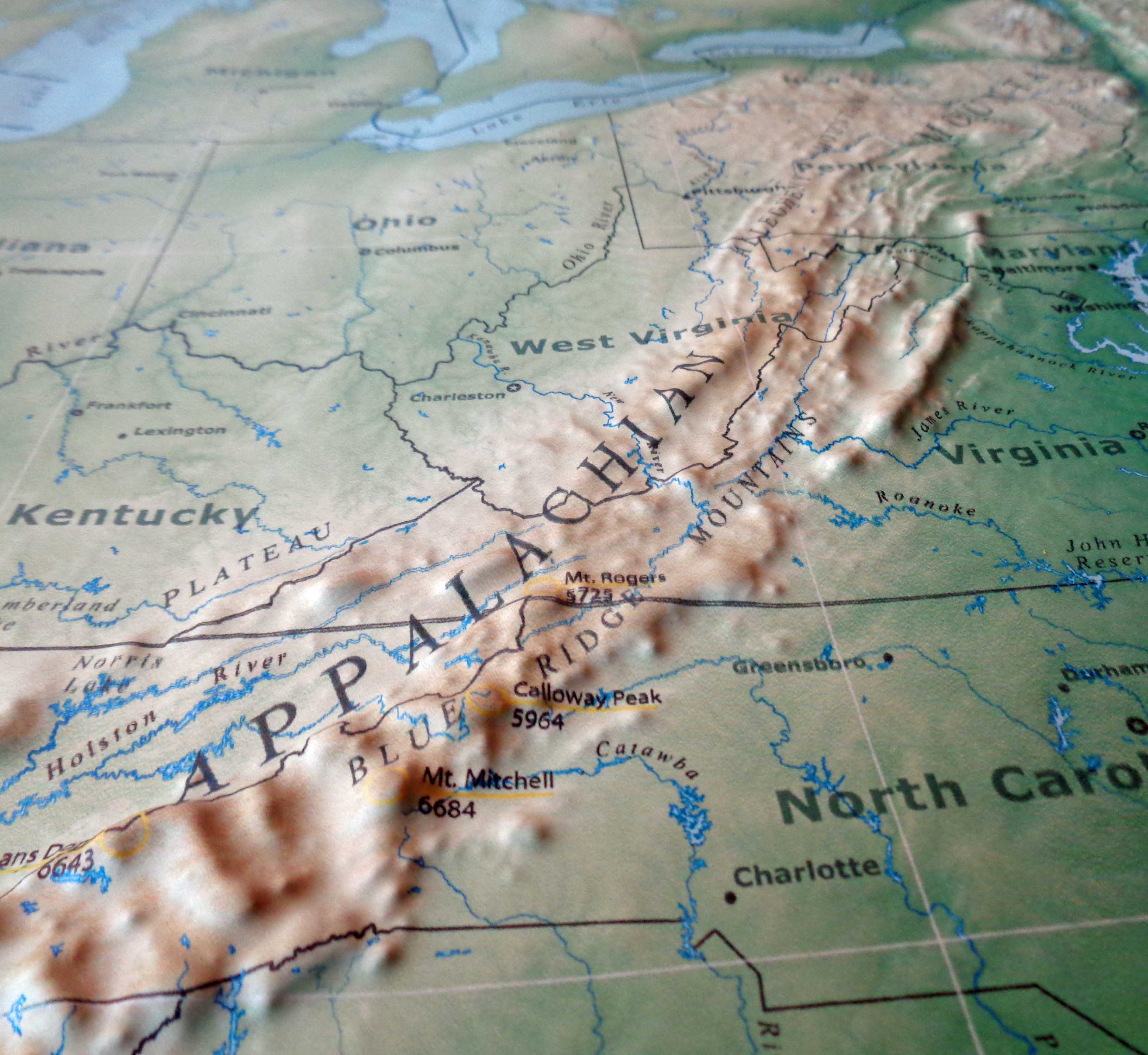
If you ask ten different people to point to Appalachian on the map, you’re going to get ten different answers. It’s a mess. Honestly, the region is less of a fixed coordinate and more of a shifting vibe that politicians, geographers, and locals have been fighting over for decades. Some people think it’s just West Virginia. Others will tell you it starts in New York and ends in Alabama.
They’re both right. Sorta.
The problem is that we’re usually looking at two different things: the mountains themselves and the "region" as defined by the government. One is a billion-year-old pile of rocks. The other is a 1960s-era political boundary designed to distribute federal funding. When you try to find Appalachian on the map, you have to decide if you're looking for coal mines, bluegrass music, or just a really long hiking trail.
The ARC Map vs. The Real World
Back in 1965, the Appalachian Regional Commission (ARC) was formed. This is the "official" version of the region that most people see in textbooks. It includes 423 counties across 13 states.
It’s huge.
We are talking about a footprint that stretches from the southern tier of New York all the way down to northeastern Mississippi. Yeah, Mississippi. Most people don’t think of the Deep South as Appalachian, but because of economic data and specific geological foothills, it’s on the map. This version of Appalachia isn't based on who wears overalls or who likes ramps; it’s based on who needs help with infrastructure and economic development.
But here is where it gets weird.
Because the ARC map is tied to money, counties often lobby to be included. This has led to "Appalachian creep." Over time, the borders have expanded further into the flatlands of Ohio and the Piedmont of North Carolina. If you look at a map from the 60s versus a map from 2026, the region looks like it’s growing, even though the mountains haven’t moved an inch.
The Physiographic Reality
Geologists have a much stricter definition. They look at the "Physiographic Provinces." This is where you find the Blue Ridge, the Ridge and Valley, and the Allegheny Plateau. If you’re standing on the Blue Ridge Parkway in Virginia, you are undeniably in Appalachia. You can feel it in your knees.
However, if you drive an hour east toward Richmond, the mountains vanish. You’re in the Piedmont. You’re technically still in an ARC-designated state, but the "mountain-ness" is gone. This creates a cultural disconnect. A person in Pittsburgh and a person in a hollow in Eastern Kentucky both live in "Appalachia" according to the map, but their daily lives look nothing alike. One is navigating skyscrapers and steel history; the other is navigating winding two-lane roads and old timber stands.
Why the Map Matters for Travelers
If you're trying to find Appalachian on the map for a road trip, don't just follow the federal borders. Follow the 2,190-mile Appalachian Trail (AT). This is the "Green Ribbon" of the region. It’s the spine.
Starting at Springer Mountain in Georgia and ending at Mount Katahdin in Maine, the AT defines the high-country culture. This is where you find the high-elevation spruce-fir forests and the "balds"—those strange, grassy mountain tops that nobody can quite explain why they don't have trees.
Real talk: the best way to see the region isn't the interstate.
Take Route 219. It runs from New York down through West Virginia and offers a much better "map" of the culture than any government document. You’ll see the transition from the glaciated hills of the north to the rugged, unglaciated plateaus of the south. You’ll see the shift from maple syrup country to biscuit-and-gravy country.
The Three "Appalachias"
Most experts, like those at the Appalachian Studies Association, break the map into three distinct chunks:
- Northern Appalachia: This covers New York, Pennsylvania, and parts of Maryland and Ohio. It’s heavily influenced by the Rust Belt. It’s where the mountains meet the Great Lakes influence.
- Central Appalachia: This is the "heartland." West Virginia, Eastern Kentucky, and Southwest Virginia. This is the area most often portrayed in movies—for better or worse. It’s coal country. It’s also where the most intense dialect and traditional music are preserved.
- Southern Appalachia: Western North Carolina, East Tennessee, North Georgia, and Alabama. This is the land of the Great Smoky Mountains. It’s currently seeing a massive boom in tourism and "amenity migration," where people move there for the views rather than the resources.
Misconceptions You’ll See on Most Maps
People think Appalachia is a monolith. It isn't.
One of the biggest mistakes people make when looking for Appalachian on the map is ignoring the cities. People think it’s all rural cabins. But Asheville, Knoxville, Chattanooga, and even Birmingham are Appalachian cities. They are the "urban anchors" of the mountains. They provide the hospitals and the universities that keep the rural areas functioning.
Also, the "Ozarks" are not Appalachian.
I see this all the time on social media. People lump them together because the culture is similar—banjos, wood-carving, independent streaks. But the Ozarks are in Missouri and Arkansas. There is a giant flat valley (the Mississippi River valley) between the two mountain ranges. Geologically, they are cousins, but they aren't the same family.
The Importance of the "Eastern Continental Divide"
If you want a truly geeky way to map the region, look for the Eastern Continental Divide. It runs right through the heart of the Blue Ridge. If you pour a glass of water on one side, it goes to the Atlantic. On the other side? It’s headed for the Gulf of Mexico via the Ohio and Mississippi rivers.
This divide dictated how the region was settled. It determined where the railroads could go. It determined which towns became trading hubs and which stayed isolated for 200 years. If you want to understand the map, you have to understand the water.
Actionable Steps for Exploring the Region
If you are planning to visit or study the area, don't just look at a generic US map. You need specific tools to see the "real" Appalachia.
- Download the "Appalachian Trail" interactive map: Even if you aren't hiking, this shows you where the highest ridges are.
- Use the ARC's County Map: Go to the Appalachian Regional Commission website and look at their "Economic Status" maps. It’s fascinating and heartbreaking. It shows you exactly which counties are "distressed" and which are "attainment." It gives you a sense of the real-world struggles of the people living there.
- Follow the "Crooked Road": If you’re in Virginia, follow the heritage music trail map. It’s a physical map of the "sound" of Appalachia.
- Check the Biodiversity Maps: The region is one of the most biodiverse places in the temperate world. Look at maps of salamander populations or freshwater mussel diversity. That's a different way to "see" the region's health.
The map of Appalachia is always changing because our definition of the region is always changing. It's a place defined by its edges. Whether you're looking at the smoky peaks of the South or the rolling hills of the North, the best way to find it is to get off the highway and look for the places where the horizon starts to wrinkle.
Start your journey by picking one of the "gateway cities" like Roanoke or Asheville. From there, head into the higher elevations where the cell service drops. That’s usually where the real map begins. Use USGS topographical maps rather than Google Maps if you’re heading into the backcountry; the terrain is much steeper than it looks on a flat screen.
Always carry a physical road atlas. In the deep folds of the Ridge and Valley province, GPS is a suggestion, not a fact. Understanding the verticality of the landscape is the only way to truly understand the map of this place.